Cangshan Mountain 220km Cycling Loop: Route & Elevation Guide
Plan the 220km Cangshan Mountain cycling loop in Dali, Yunnan. Section-by-section breakdown of 3,224m of climbing, the 3,025m Luoping Pass, pacing, gearing and support options.
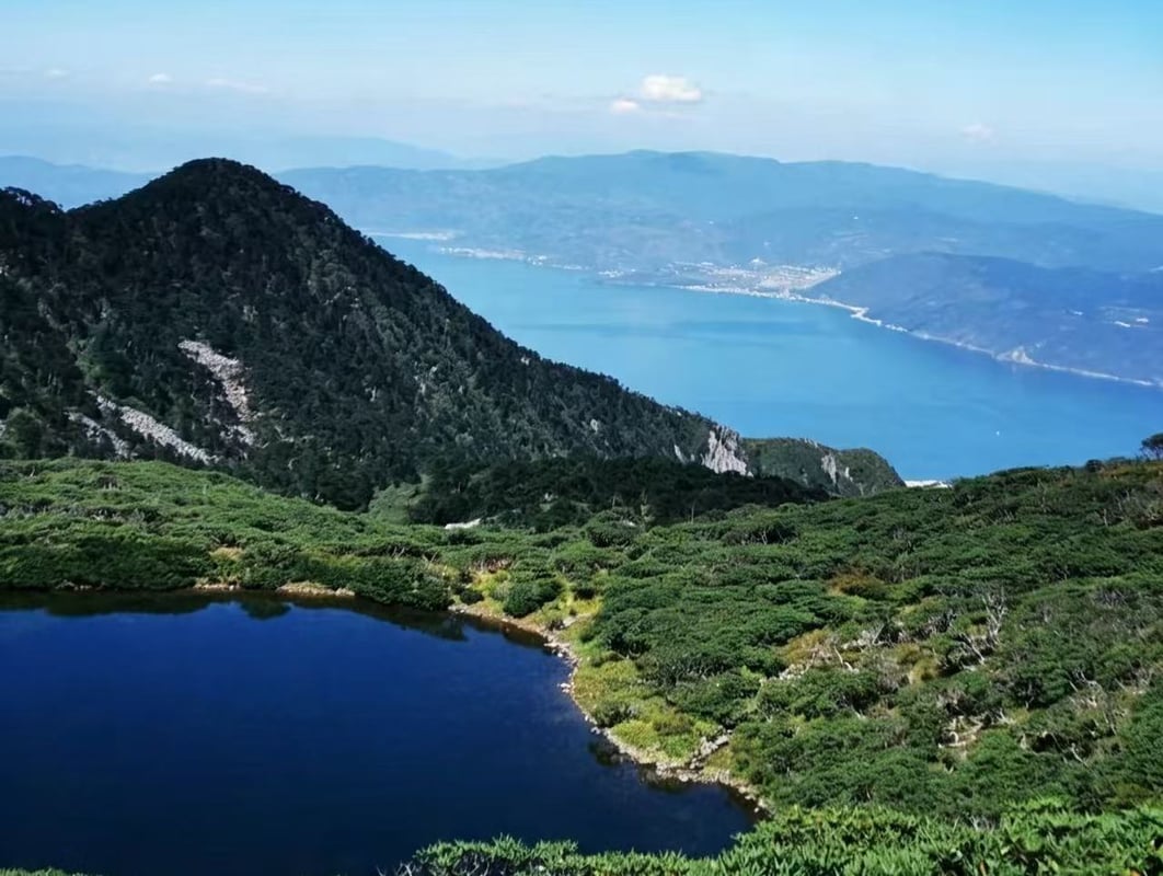
Most riders who come to Dali ride around Erhai. A much smaller number ride around the mountain instead. The Cangshan loop is 220 kilometres with 3,224 metres of climbing in a single day, topping out at 3,025 metres on Luoping Mountain Pass, and it is the hardest day ride we run anywhere in Yunnan.
This is not a scenic day out with a long option. It is an endurance objective that needs a 06:00 start, high-altitude climbing legs, and a plan for what happens if you cannot finish. Our team last inspected the full loop on 7 August 2026.
Before you ride
Quick answers
How hard is the Cangshan loop?
Extreme. 220 km and 3,224 m of climbing in one day, with a 30 km sustained ascent to 3,025 m.
How long does it take?
13 to 14 hours. Start 06:00–07:00 to be back before 20:00.
What gearing do I need?
A compact chainset with an 11-32T or 11-34T cassette. Do not attempt Luoping on race gearing.
Can I ride it on an e-bike?
Only with a support vehicle carrying spare batteries. No single battery covers this route.
Route Overview
The loop starts on the western shore of Erhai near Dali Old Town and runs clockwise around the whole Cangshan massif, crossing Dali City and Eryuan County. You head south first, then turn west into the Heihei River Valley and climb steadily into the mountains, over Luoping Pass, and down into the agricultural basin at Eryuan. The last third comes back along the lake.
The two halves feel like different rides. The valley approach is quiet river basin and Bai villages on light-traffic roads. Above Liantie it becomes an alpine road: switchbacks, forest, cold air and thinning oxygen for thirty kilometres.
Route Breakdown
Section 1: Caicun to Pingpo Town — 0–24 km
1,970 m to 2,050 m, a gentle +120 m. Paved G214 national highway with steady morning traffic. Treat this purely as a warm-up and hold a conservative cadence — nothing you gain here survives the day.
Section 2: Pingpo Town to Liantie Township — 24–90 km
2,050 m to 2,480 m, +760 m in segments. Paved roads along the Heihei River Valley, minimal traffic, open valley scenery. Aim to reach Liantie around 11:30 for lunch. Eat properly — rice and protein, not just gels — and restock before the climb.
Section 3: Liantie to Luoping Mountain Pass — 90–120 km
2,480 m to 3,025 m, +890 m of continuous switchbacks through mountain forest. Air temperature at the top typically runs 6–8°C below the valley. Reach the pass by early afternoon. There is only a basic kiosk for water; do not linger in the cold wind at altitude.
Section 4: Luoping Pass to Eryuan County Town — 120–165 km
3,025 m down to 2,000 m, including a continuous 22 km descent. Paved but with numerous sharp mountain turns. Manage your braking and your body temperature — you will be cold and moving fast at the same time. Arrive Eryuan around 15:30, eat again, and change out of sweaty layers before the evening drop.
Section 5: Eryuan to Xiaguan Erhai Park — 165–195 km
Rolling terrain around 2,000 m with a further +420 m of climbing. This is where the day is won or lost: the climbing is minor on paper and brutal on tired legs.
Section 6: Xiaguan to Caicun 214 Cycling Station — 195–220 km
Flat lakeside riding along Huanhu West Road back to the start. Target arrival before 20:00.
Distance, Elevation and Difficulty
Two hundred and twenty kilometres and 3,224 metres of climbing in one day puts this squarely in the extreme category, and three factors compound each other:
- Altitude. The route tops out at 3,025 m. Reduced oxygen availability accelerates fatigue on exactly the section where you need most of your reserves.
- Duration. You have to hold an active pace for 13 to 14 hours to finish before dark.
- Technical descending. The 22 km drop off Luoping demands sustained braking control, alertness on blind switchbacks, and thermal management as you lose a thousand metres of altitude at speed.
Road Surface and Traffic
- Surface: entirely paved — national highway and mountain road.
- Traffic: variable. The G214 sections carry regular motor traffic; the valley between Pingpo and Liantie is very quiet.
- Corners: blind switchbacks on the Luoping descent need caution, especially after rain.
Who Is This Route For?
Recommended for
- Riders who have completed several 200 km+ days with substantial climbing
- Cyclists comfortable riding and climbing above 2,500 m
Not suitable for
- Beginners, casual leisure riders, or children
- Riders without experience managing pacing, nutrition and hydration across a full mountain day
Recommended Bike and Gear
- Bike: lightweight road bike or drop-bar endurance bike.
- Gearing: a compact chainset (50/34T) with a wide cassette (11-32T or 11-34T) is strongly recommended for the 30 km Luoping ascent.
- E-bikes: permitted, but one battery will not cover 220 km and 3,224 m. A support vehicle carrying charged spares is mandatory, not optional.
- Clothing: windproof and insulated layers for the summit and descent, high-output front and rear lights, rain jacket, spare tubes.
Resupply and Pacing
- Stops: Pingpo Town, Liantie Township (lunch), Luoping Pass (water only), Eryuan County Town (dinner snacks), Erhai Park.
- Strategy: start at 06:00–07:00 and ride the Heihei River Valley conservatively. The valley is deceptively easy and the single most common mistake is arriving at Liantie already deep into your reserves.
Best Season and Weather
- Recommended months: April through November.
- Summer rain: reduced traction on alpine descents and roadside debris after storms.
- Winter and early spring: frost or ice above 2,800 m, plus significant wind chill.
- Temperature spread: expect 6–8°C colder at the pass than in the valley.
Navigation and Safety
- Navigation: a loaded GPX track on a dedicated bike computer, not a phone. You will be out longer than a phone battery lasts.
- Mobile coverage: generally good across the route.
- On the road: daytime running lights, obey highway lane rules, and keep descent speed inside your own margin.
Emergency and Shorter Options
- Evacuation: if exhaustion, altitude sickness or a mechanical ends the day, vehicle pickup has to be arranged in advance. There is no casual taxi option at 3,000 m.
- Two-day version: the same loop splits cleanly into two days with an overnight near Eryuan or Liantie. For most visiting riders this is the better trip, not the consolation prize.
Riding It With CycleQuest China
Experienced, self-sufficient riders can navigate the loop from the GPX file alone. Guangxi Qiyi Culture Tourism Development Co., Ltd. (CycleQuest China) provides road bike rental as standard — see Dali bike rentals — with optional paid add-ons:
- English-speaking guide
- Support vehicle for gear, spare batteries and photography
- Hotel transfers
- Emergency pickup
Mechanical support and luggage transfer are not included. To ride Cangshan as part of a longer trip, see our Dali cycling tours, or send a rental request with your dates.
FAQ
How difficult is the Cangshan Mountain 220 km loop?
Extreme. Riders cover 220 km and climb 3,224 m in a single day, reaching 3,025 m at Luoping Mountain Pass.
Can it be completed on a standard road bike?
Yes. The route is fully paved, and a road bike with compact climbing gearing — a 34T inner ring with a 32T or 34T cassette — is the recommended setup.
Is an e-bike suitable for the full 220 km?
Not on one battery. E-bike riders need a support vehicle carrying pre-charged spares; without it you will run out of assistance mid-climb at altitude.
What is the highest point on the route?
Luoping Mountain Pass at 3,025 metres, reached at roughly the 120 km mark.
What support does CycleQuest China provide?
Bike rental as standard. English-speaking guides, support vehicles, transfers and emergency evacuation are optional paid add-ons. Luggage transport and mechanical repairs are not included.
Can the loop be split over two days?
Yes, and for most riders it should be. An overnight near Eryuan or Liantie turns an extreme day into two hard but enjoyable ones.